Hiking (mountain trail, in places narrow and exposed)
Alpine route (equipped or very exposed section, snow field, blocks)
C8
Engelberg » Meiringen
|
12h23 |
29 km
|
1704 m
|
2107 m
Leave Engelberg on a steep southward climb to the Gerschnialp. The mountain trail leads past the Trüebsee lake to the Joch pass and Bärghuis Jochpass where is an ideal place for a stopover for lunch or coffee/dessert. This section can also be covered using aerial cable cars. From the pass, continue down to the Engstlenalp. After a short ascent reach the Tannalp where the showcase cheese dairy, hotel and mountain lake invite to linger on. Then the trail leads on a ridge to the Balmeregghorn mountain and further to Planplatten, with a fantastic view on the Bernese Alps. From there, the descent to Meiringen can be shortened using the lifts.
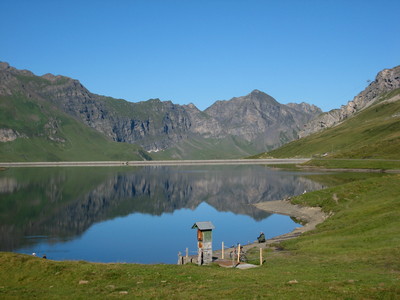
From Engelberg train station, head westward to the bridge over the Engelberger Aa river. Immediately after the bridge, turn into the wood and follow the mountain trail steeply uphill. This finally leads across alpine meadows to the Gerschnialp. Continue on the moraine ridge on a slightly uphill course to reach the rock face of the Gerschniberg. From here, the mountain trail winds its way in many hairpin bends up to the Trübesee mountain station. Pass the Trüebsee lake to arrive at the valley station of the Joch pass chair lift. This is where the actual pass trail starts, and it winds its way up in many sharp bends on the Ochsenhorn mountainside to the Joch pass. Here, the tremendous view over the Titlis glacier world and the summits of the Nollen, the Wendenstock and the Pfaffenhut following to the south can be admired. The Engstlensee lake twinkles far below. From the pass, the mountain trail leads over flowery pastureland down to the Engstlensee lake framed by splendid cembran pines and on to the Engstlenalp. This entire area in the middle of a magnificent mountain landscape and its idyllic lake are under nature protection. After a short ascent, reach the Tannen and Melchsee-Frutt high plateau. From the Tannensee lake, a balcony trail leads on a mountain shoulder and later on a ridge to the Balmeregghorn mountain and then further on to Planplatten. Along the whole of this stretch, a unique view over the Rosenlaui area, the Engelhörner mountains and the triumvirate of the Wetterhorn massif can be enjoyed. The long climb down leads across alpine meadows to Reuti and then in the forest on a steep road with many bends, all the way to Meiringen.
(Schweizer Wanderwege)
Natural and cultural heritage
Engelberg The Engelberg valley, set in the middle of a magnificent mountain landscape, can look back over an interesting past. Even at the time of Christ, various alpine meadows stretching over the valley floor from Nidwalden were stocked with cattle. In the early 12th century, Baron Konrad von Sellenbüren built the Benedictine Monastery of Engelberg. The monastery church boasts many church treasures and paintings by Wyrsch, Deschwanden and many others. In front of the church stands the Beinhaus building, built in 1608 in late Gothic style, which is also the oldest of the five valley chapels of Engelberg. There were monastery fires in 1200,1306 and 1729. Today’s monastery church and the convent building were rebuilt by Johannes Rueff after the last fire in 1730-1737. They form a closed complex, completed in the 19th and 20th centuries by extensions for the school established in the monastery. The valley people of Engelberg gained their independence in 1798 and formed the new canton of Waldstätte. In 1803, the Helvetic Republic was dissolved and with it the canton of Waldstätte. Engelberg first of all went to the canton of Nidwalden, but then in 1815 was attached to the canton of Obwalden. 1898 saw the opening of the Stansstad-Engelberg railway as the first electricity-powered mountain railway in Europe. Today, Engelberg is a world-renowned summer and winter spa resort. It offers an extensive network of rambling and hiking paths, numerous sports facilities, holiday concerts, etc. Meiringen The name of the main town, Magiringen, appeared for the first time in a document in 1234. Thanks to its location, Meiringen was an important centre for travellers from a very early stage. At the time of the stagecoaches, for example, around 300 stage horses were stationed in the town. Meiringen is both the starting point and destination for the important Grimsel, Susten and Brünig pass roads and for the Grosse Scheidegg and Jochpass crossings. The Alpnachstad-Meiringen-Brienz railway line was opened in 1888. The church of St. Michael is of important historical cultural significance with its interesting frescoes from the 13th and 15th centuries. On the occasion of the renovation work undertaken in 1915, the remains of seven earlier churches were discovered under today’s church, the origins of which date back as far as the 11th century. The scree washed down by the torrential streams of the Hasliberg had always covered them over. Take the steps down to the exposed, original border walls and the Roman altars. Near the church stands a Roman bell-tower, which is assumed to have been erected as a fortress tower to protect the locality and the traffic on the pass. In this tower hangs the oldest bell in the canton of Bern dating back to 1351. The former early mass chapel is also worth visiting. It is situated on the southern edge of the churchyard. In 1480, it was submerged in scree, but in 1486 rebuilt again. In 1933, it was very tastefully renovated. Hasli landscape museum, near the church. Sherlock Holmes exhibition.
(Schweizer Wanderwege)
Useful topographic maps
245 T Stans ~ Swisstopo (1:50'000)
255 T Sustenpass ~ Swisstopo ( 1:50'000)
Useful guidebooks
Berner Oberland Ost ~ Bergverlag Rudolf Rother GmbH (ISBN 3-7633-4012-2)
Favourites, criticisms ? Make your personal comments on this stage. For more general notes please use the comments section of the page Over to the Via Alpinists.
Eric db - 2022-09-14
Au sud-est de Meiringen, près de la piscine, la Simons Herberge est une possibilté d'hébergement assez économique, toujours en activité en 2022. Contact: 00 41 (0) 33 971 17 15
Arturo Ciórraga - 2020-08-10
La etapa es demasiado larga, y es necesario partirla. Una buena opción es hacer noche en Tannalp. Buen albergue, restaurante y próximo al lago. También opción de acampada libre.
La ruta entre Tannalp y Meiringen tiene un bonito tramo a través de la cresta de la montaña.
Es una lástima que en algunos tramos el sendero antiguo está absolutamente destrozado por las rodadas y erosión de las bicicletas, y se ha sustituido por una insípida pista de grava.
Schöne 2 Tageswanderung mit Übernachtung auf der Tannalp. Nach 5 Jahren jetzt endlich den Abschnitt Vaduz - Adelboden abgeschlossen =) ... Empfehlung: Übernachtung im Berggasthaus Tannalp, tolles Essen und super Gastgeber!
Automatic translation
[Google]
Nice 2-day hike with overnight stay on the Tannalp. After 5 years now finally the section Vaduz - Adelboden completed =) ... Recommendation: Overnight stay in the mountain inn Tannalp, great food and great hosts!
tof - 2015-01-18
Trieste-monaco
- le 28/8/14
Une étape encore très longue.
A Engelberg, auberge de jeunesse (Berghaus familienherberge). 39 CHF (nuit et petit déjeuner obligatoire, dommage!). Toutes commodités à Engelberg.
Passage du Jochpass et depuis le Engstlensee vue sur les glaciers des prochaines étapes. Passage au second lac, Tannensee. Présence d'un fuerstelle au bord du chemin.
Bivouac au-dessus du lac, à 5 minutes, en zone plutôt humide!
- Le 29/8/14
Départ pour Meiringen. Passage à Planplatten. Le chemin continue en crête sud-ouest puis descend ouest. A partir de Undere Stafel, ferme d'alpage pour ravitaillement (prix du fromage 23 CHF). A Meiringen, toutes commodités. Nuit au camping Balmweid, Balmweidstrasse 22. Douche non payante. Très bon accueil en ce qui nous concerne.
Automatic translation
[Google]
Trieste-Monaco - the 28/08/14 A very long stage again. In Engelberg, youth hostel (Berghaus Familienherberge). 39 CHF (small night compulsory breakfast, shame!). All amenities Engelberg. Passage Jochpass and from the view of the glaciers Engstlensee next steps. Passage to the second lake, Tannen. Presence of fuerstelle the wayside. Bivouac above the lake, 5 minutes, rather wet area! - The Departure 08.29.14 Meiringen. Planplatten passage. The path continues south-west ridge and then down west. From Undere Stafel, farm pasture for refueling (cheese prices 23 CHF). A Meiringen, all amenities. Overnight camping Balmweid, Balmweidstrasse 22. Shower not pay. Very welcome in regard us.
Monaco - Trieste
Meiringen - Planplatten 4h.A skier cabin brings up the tourists up there
Planplatten - Tannenalp about 2h flat,slightly up & down
Tannenalp - Jochpass another 2hours, another ski lift is operating from Engstlenalp to Jochpass
From Jochpass restaurant, Engelberg is marked 3h. another cabin operating Trubsee - Engelberg.
Dom Lalot - 2013-09-01
A Reuti, on peut faire les courses et aller au camping qui est plein nord à 1,5km à Goldern. Dans le sens vers Trieste, c'est une bonne solution, pour alléger l'étape suivante.
Automatic translation
[Google]
A Reuti, you can go shopping and go to the site which is due north 1.5 km Goldern. In the direction towards Trieste, it is a good solution to alleviate the next step.
Andrew - 2012-09-29
Be careful on which direction you go if you are following the sign at Balmeregghorn. We were there last week and the bolt at the bottom was loose causing the sign to freely swing and give wrong directions depending on the direction of wind.
I tried to tighten it down by hand with it in the right direction but it probably wont last long.
If you're up there before its fixed, just point the blue sign toward the blue trail, and you'll get the correct heading.
Via Alpina International Secretariat - 2012-06-28
The information has now been updated in accordance to the markings and the guidebook. The trail now runs along a magnificent ridge rather than at the bottom of the valley, and there are more opportunities for shortcuts using lifts.
joan - 2011-09-22
In Meringen, one of the best and cheapest lodge of the whole Via Alpina in Switzerland, Simons Herberge: Half board on a single room, 57 Sf. Or half board on a dortoir, 48 Sf. (September 2011)

 |
12h23 |
29 km
|
1704 m
|
2107 m
|
12h23 |
29 km
|
1704 m
|
2107 m


Favourites, criticisms ? Make your personal comments on this stage. For more general notes please use the comments section of the page Over to the Via Alpinists.